What can you tell about a city from the numbers?
I’m about to spend two weeks engaging in one of my favorite passtimes – driving to unfamiliar cities and attempting to “figure them out”. Why is this city where it is? Is it growing or shrinking? Where do people work? What do they do for fun? And most importantly, where should I eat?
I’ve gotten into the habit of pulling up certain statistics when I visit a new city – the first thing I do is scroll a city’s Wikipedia entry to its “demographics” tab. I want to know whether a city is growing or shrinking, and I particularly want to know when its peak population was. A city that peaked in the 1900s (North Adams, MA) feels really different from one whose best days were in the 1960s (Pittsfield, MA, my hometown.) And both are distinctly different from cities that are still growing, and particularly from those whose greatest period of growth is recent.
As I head off on my road trip, I’m compiling mini-dossiers on the cities I’m heading towards. I’m bringing together a few different data sets – Wikipedia gives me peak and current population, and some key facts about where people work now and where they used to work. I’m organizing the trip around the median house price/income ratio, so that comes in including ranking in terms of all 384 metropolitan statistical areas. This wonderful US Census site gives me the racial breakdown and the percentage of population that’s foreign born, which helps me figure out whether a city is attracting immigrants. And First Street Foundation’s Risk Factor offers climate risks in five categories: flooding, wildfires, wind (hurricanes, tornados, derechos), air quality and heat. (Each of those risks runs from 0-5, so I think of the aggregate risk as being out of 25.)
As for the critical questions of where to eat and what to see, that one’s harder. I look at Yelp, Trip Advisor and Google Maps, but trust all of them less than local restaurant guides, or specialized sites like Eater. (Their Berkshire county guide isn’t perfect, but it’s damned good.) I’m particularly interested in what I call “statistically improbable restaurants”, i.e., restaurants that feature a cuisine not normally seen in a small city. A Burmese joint in NYC doesn’t mean anything, but a Burmese restaurant in a city of 40,000 likely means a well-established Burmese immigrant community.
I tend to hit up Atlas Obscura and Roadside America for possible destinations, as well as Trip Advisor.
But it’s obvious that numbers don’t tell the whole story, which is why it’s worth taking road trips. I’m trying to be conscious that these data points are designed to help me know what to look for, and trying to make sure they don’t blind me to what’s worth seeing.
So, here’s a test, using a city I know very well.
Pittsfield, MA, seat of Berkshire County, MA.
Population 44,000. Peak population 58,000 in 1960 (Currently at 76% of peak population)
Formerly home to GE’s High Energy laboratories, GE Plastics
Now a regional center of culture and tourism, healthcare as major employer
Housing/Income ratio: 3.9 (155 of 384) – very low for New England
+0.45% net international migration, – 1.75% population growth 2020-2023
88% white, 5% black, 6% hispanic. 6.8% foreign born
Climate risk: Moderate flood, Moderate wildfire, Moderate wind, Minor air, Minor heat (2,2,2,1,1 – 8/25). Ongoing cleanup from PCBs from GE transformer manufacturing
Attractions: Hancock Shaker Village, Arrowhead (home of Herman Melville), theaters, museums
Food: La Fogata (Columbian), Dottie’s, Brazzuca’s market (Brazilian)
(Several reviews mention mini-hot dogs as a local cuisine.)
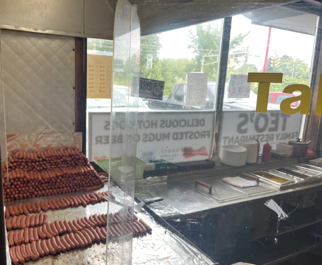
These dogs are from Teo’s, though I am partial to the Hot Dog Ranch. In any case, they are ordered “with everything”, which means meat sauce, mustard and chopped onion. Why? Dunno, don’t care.
And here’s a more personal take, from a blogpost I started writing, attempting to introduce this series/road trip. I was wrestling with the idea of “unfashionable cities”, a term I’m experimenting with to refer to cities that, for whatever reason, are not places people are excited to live in. (I’ve thought about “value cities” as well, but “value” like “fashion” is a complex and multifaceted term. “Bargain cities” or “undervalued cities” can feel demeaning, even if there’s some truth to the idea that these cities are very good value for the money. I’m still working through it.)
Pittsfield, MA describes itself as “the heart of the Berkshires”, a scenic stretch of western Massachusetts blessed with beautiful scenery across all four seasons, a wealth of music, theater and dance festivals, world-class art museums and educational institutions. I have lived here since 1989 and – despite many opportunities to move away – I plan to be buried here. But I appear to be the exception, not the rule.
General Electric based its transformer division in Pittsfield from 1907 to 1987, a major center of research and development, a “crown jewel” for the massive and powerful company. At the peak of GE’s presence in Pittsfield in the 1940s, 13,000 of the town’s 50,000 residents worked for the company. GE’s presence attracted defense contractors and other manufacturers and the city’s population peaked in the 1960s at just shy of 58,000.
It’s been downhill since, population-wise. Pittsfield’s population has shrunk in every subsequent decade and now stands at roughly 43,000. When GE closed the transformer division in 1987, it not only knocked out a major pillar of the local economy, it left much of its former footprint – and the Housatonic River – contaminated with carcinogenic PCBs. GE’s presence in the area while I’ve lived here has mostly centered on environmental cleanup.
It’s easy to understand how a city that lost its biggest employer and gained a brownfield might have a bad reputation. In the 1990s and 2000s, Pittsfield was a national leader in teen pregnancy, documented in Joanna Lipper’s Growing Up Fast. Fentanyl is a serious problem now, with one of the highest overdose rates in the state. (The rates are higher in the unfashionable cities of Fall River and Springfield, two cities that have similar histories of deindustrialization and shrinkage.) For a few years in the early 2000s, anyone driving into the city from the north was greeted by a giant sign in front of a shuttered liquor store that read “Fuck You Pittsfield”, presumably a parting shot from a failed businessman.
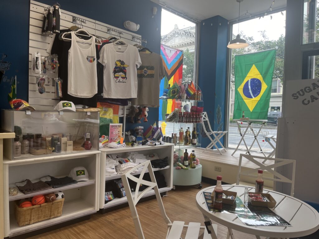
Brazzuca’s. Rapidly becoming one of my favorite lunch places on North Street.
But Pittsfield is turning around. A wave of immigrants have opened new businesses on North Street, once filled with vacant storefronts. Within a mile downtown, you can find Brazilian, Salvadorean and west African markets, as well as Colombian, Dominican and Caribbean restaurants. (The liquor store that once sported the unfortunate sign is a Hispanic market, run by a Venezuelan immigrant.) The once-shuttered Colonial Theater reopened in 2006 and hosts performers from around the world. A boutique hotel sited in two 1880s brick buildings anchors the opposite end of the street from the Colonial. A new economy is slowly emerging around the arts, medicine, and precision manufacturing.
One thing Pittsfield has done well is to shrink responsibly. The city had several distinct shopping areas in the 1960s and 1970s, but it can’t support multiple “downtowns” at this point. For the past couple of decades, the city has been encouraging businesses to occupy real estate on North Street, the main downtown street, in part through a once a month festival that lines the street with food carts and performers. There are empty storefronts in the city, but far more so in the outer commercial areas, and few on the main drag.
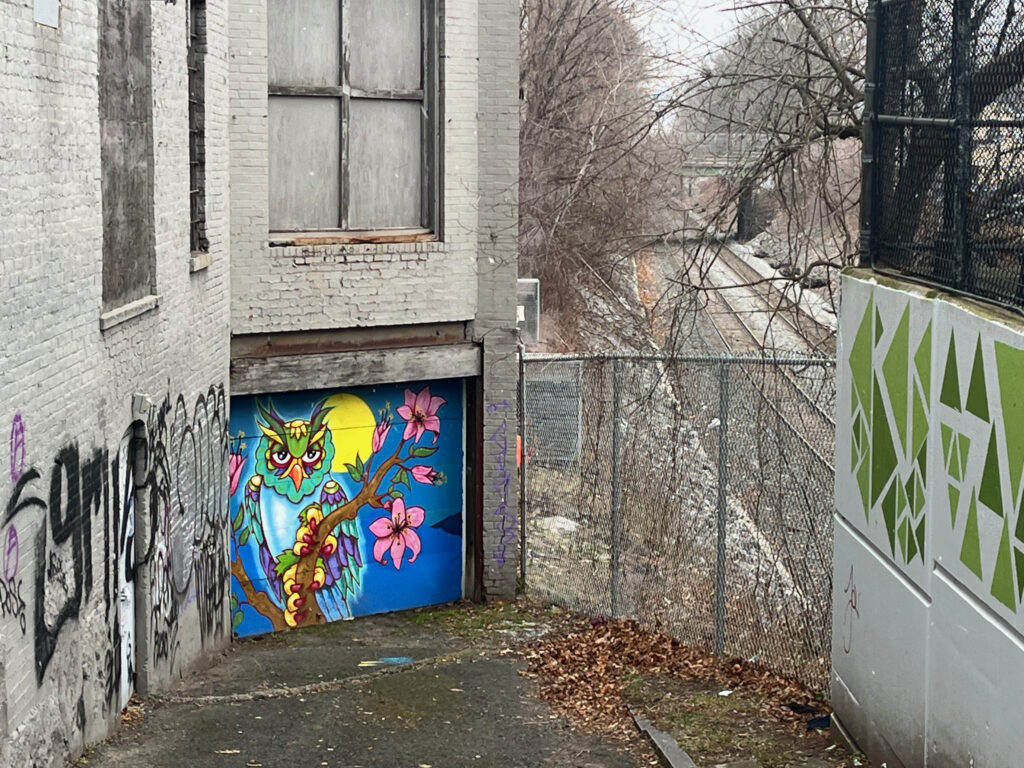
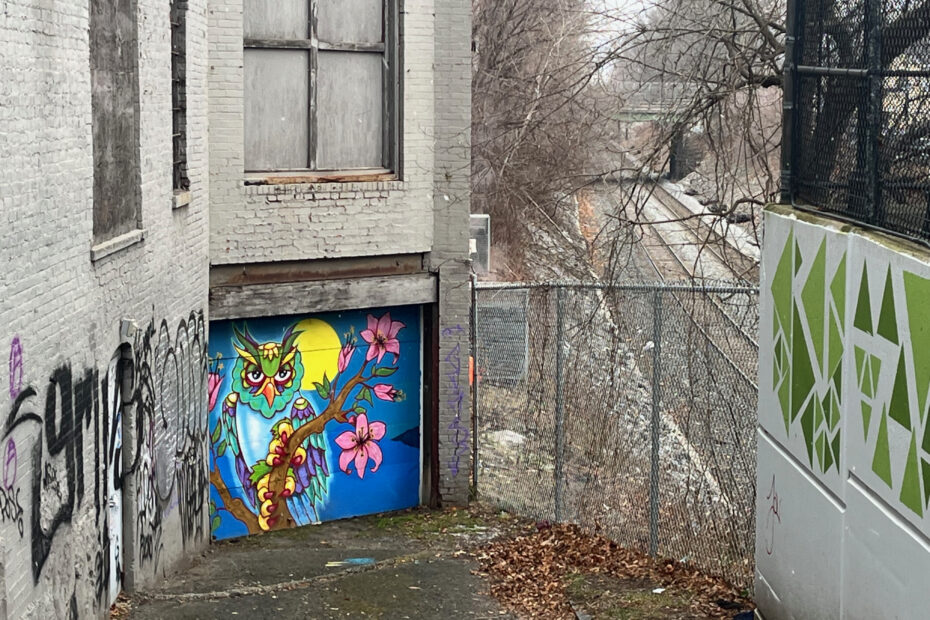
One of the many murals that’s blessed North Street in the last couple of years, this one tucked away by the freight tracks.
In addition to an increasingly lively downtown, Pittsfield is incredibly well cited. It’s surrounded by beautiful rural areas in all directions, with hiking trails, lakes and ski areas all nearby. There’s a long tradition of summer arts festivals in the region, including the Jacob’s Pillow dance festival, the Tanglewood music festival and two top theater festivals. The Clark Art Institute, MassMoCA and the Norman Rockwell anchor a set of world-class museums. It can feel at times like Pittsfield is an afterthought to some of these regional destinations, with people passing through to see the cultural treasures of the area. But Barrington Stage is selling out shows in downtown Pittsfield and the beautifully restored Colonial Theater is attracting national touring acts.
Yet Pittsfield remains a comparatively unpopular place to live. It’s one of only five metropolitan statistical areas (a census designation for a city or town and the set of suburbs and economically connected communities around it) to have become a better deal over the past thirty years. While it makes sense that a city which lost its largest employer and has shrunk significantly would become a cheaper place to live, it’s also a bit of a surprise. Some similar communities closer to New York City gained lots of urban refugees during the pandemic, raising real estate prices and goosing local economies. Pittsfield is a bit too far north, too far from train lines to make a trip into Manhattan easy to accomplish. And while the Boston suburbs continue to increase in density and expense, there’s no sane way to commute from the Berkshires to the Boston area, something I say with confidence after doing it for seventeen years.
Like a lot of the cities I’ll be visiting on this trip, Pittsfield needs to be understood in terms of its past: it was one of the centers of gravity for GE, and every inch a company town, and now it’s not. There’s a hope for a patchwork of smaller employers to fill the gap, but it’s harder to answer the question of “Why is there a city here?” than it was half a century ago.
That leads me to an animating question for this trip: what happens to a city when the reasons for it change? Lots of cities pivot – the loss of gold prospecting isn’t a major obstacle to San Francisco’s success, and it’s been a long time since the coastlines of New York City were lined with shipping docks and garment factories, yet those cities have settled comfortably into their new identities. Cleveland, blessed with coal and iron ore, a navigable river and Lake Erie, still remains a manufacturing town in many people’s minds, even though the auto parts manufacturers moved out long ago, and an economy around healthcare and banking has taken hold. The generation for whom Pittsfield was about GE is dying out, and it’s being replaced by people for whom the city is an inexpensive (by New England standards) place to build a family and find a foothold. How will they – we – think of Pittsfield some decades from now?
>>there’s no sane way to commute from the Berkshires to the Boston area, something I say with confidence after doing it for seventeen years
Ahahahahaha facepalm.
Hope your trip is lovely.
This is so beautiful – specifically this read on Pittsfield but not generally this concept
Thanks for taking the time to write this
Pingback: Road trip: The Company Town and the Corn Fields - Ethan Zuckerman